• Welcome to the official EU LOWA webshop
  • Free shipping & free returns from 80 € order value

EISland

We experience Iceland in the off-season. In mid-May, we head to the island with the ambitious goal of climbing the highest mountain with the unpronounceable name of Hvannadalshnúkur in a motley group.

Þetta reddast, an Icelandic plea for serenity

Icelanders are relaxed about dealing with problems, both big and small. Creative solutions are welcome, as are makeshift solutions.

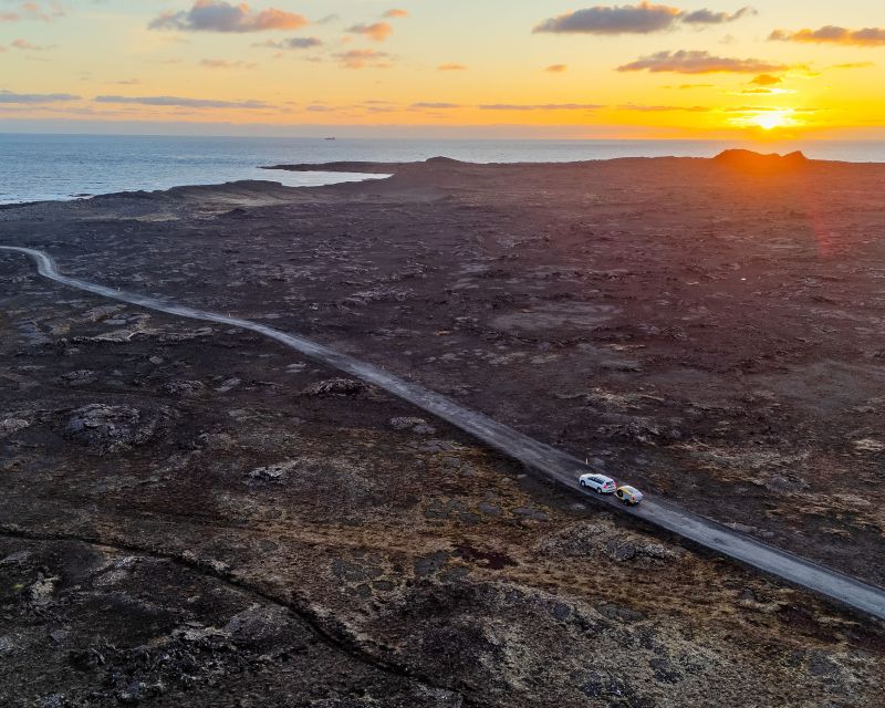
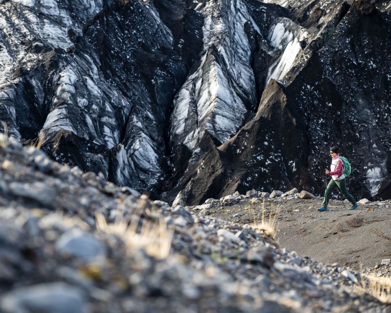
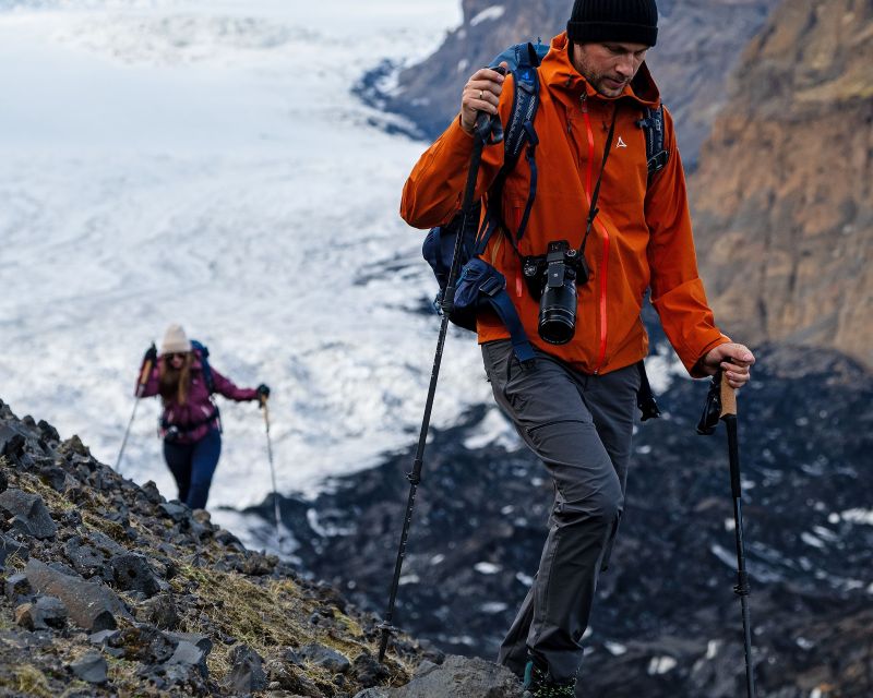
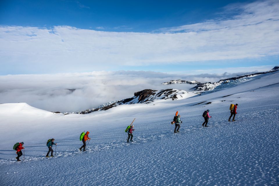
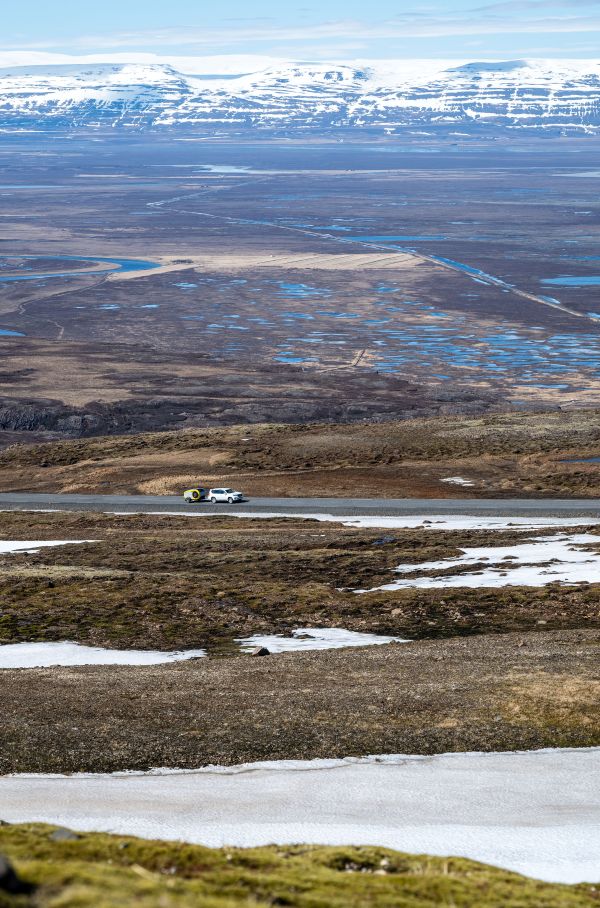
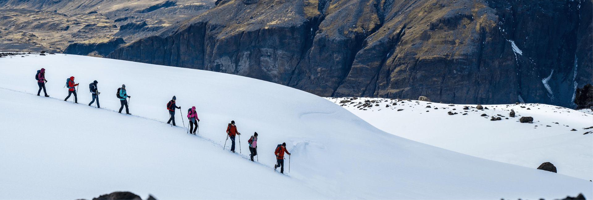
The fact that we want to climb to the highest point in Iceland with an alphorn comes as no surprise to anyone on this island in the Arctic Circle. People are used to Björk and Sigur Ros with his fantasy language or opening the doors of a penis museum - nothing is impossible here. We are humorously supported in our not-so-easy endeavour. After all, we have 23 kilometres and around 2,000 metres of altitude to cover before we can claim to have reached Hvannadalshnúkur, the highest icy peak in Iceland.

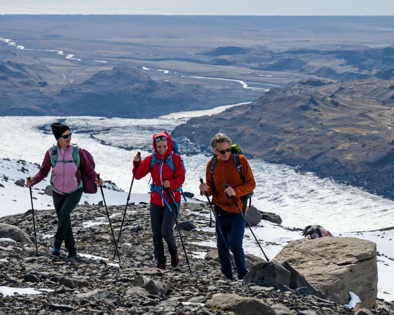
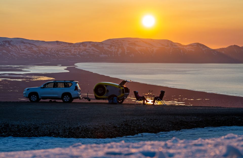
As far as the weather is concerned, all we need now is the benevolence of Thor, the god of thunder, before we are granted access. Unfortunately, he seems to be a little overzealous. Two days before our departure, it is clear: "The day after our arrival in the early evening, the island is already under the influence of high pressure, making it ideal for a Summit Bliss". However, our guides strongly advise against this "rush job". The action would be doomed to failure. Demanding such a performance when you are overtired does not work.

We have been discussing a possible summit day in our weather task force group for days. "This mountain has its own microclimate," says Elìn calmly. As one of the founders of Icelandic Mountain Guides, she knows these kinds of discussions only too well. "You'll hear from us," she writes before we board the plane to Keflavik.

Hmm, so we let go and focus first on the beautiful places that we have found through intensive research in the run-up to our trip. Of course, we put our heads together here and there in our various weather apps. We haven't quite inhaled the Icelandic serenity yet.

Glacier Panorama Trail

10 out of 10 points for a fantastic hike along the Katla volcano, with stunning views of the Mýrdalsjökull glacier.

After a 2.5-hour car journey just outside Vik, we lace up our hiking boots to get into the groove on Iceland's highest mountain. We are driven, or rather shaken, into the mountains with our guide in a 4x4 vehicle suitable for the highlands. The winter was long and snowy, so we set off in the snow.

  • We are a group of outdoor-loving friends from different countries, some with grown-up children, travelling to climb the five highest mountains in the Nordic countries. We have been together on Halti in Finland, Galdhøppigen in Norway, Kebnekaise in Sweden and Møllehøj in Denmark. This time it's Iceland's turn, then we'll have the "Nordic high five" of the Scandinavian summits in our summit diaries.

The Glacier Panorama Trail follows an old route where sheep are driven out of the mountains in autumn. Réttir is the name of the nationwide round-up in which Icelanders bring their flocks out of the mountains and valleys on foot, on quad bikes or on Icelandic horses. Entire villages and the townspeople lend their support.

The route leads gently uphill and downhill until we see the Mýrdalsjökull glacier at the last edge of the mountain. Piled up masses of ice pushing towards the valley present themselves sublimely for kilometres in a panorama that is difficult to squeeze into words and certainly not into a single picture. Katla and Eyjafjallajökull, you know... the one with the ash!

We follow the path along the ridge into the valley. It winds its way through canyons, climbs again to sensational viewpoints, before we arrive at our destination at the end of the glacial lake at Sólheimajökull after 7 hours. Tired, but full of overwhelming impressions.

N64 57,874 W15 09,199

As we park the cars and cross the old wooden bridge, we embark on an adventure into the past.

Unfortunately, the weather forecast was right. The clouds are hanging low here in Vik and it's raining. It doesn't look any better for the next few days either. Our goal of climbing the summit is receding into the distance. It's better in the east of the island. Let's get there, because there's plenty to do and see along the way. Our two Mink campers are always with us. Two stylish trailers for sleeping and cooking. Practised minimalism with a high level of comfort in a spacious ambience.

A hot bath is always a good idea. We stop off at the hot tubs in Hoffell. Our "icebreaker" Geertje, as she is called in the title of her new book, also likes to go ice bathing in the glacier lagoon... alone. In the evening, we prefer to listen to her talk about her Greenland crossing in the warm kitchen.

On the gravel road of the Faxi Pass, the scenery in the evening light is once again gigantic. We roll into Wilderness Camp, completely enthralled.

In the lovingly restored farm, we learn about the village's past and its former inhabitants. In a small museum underneath our historic dormitory, we learn a lot about the life of the people who lived in this place near the Icelandic highlands. Every detail on the site has been recreated in the original style, so you are constantly on a journey of discovery.

  • On a short hike in the valley with 15 impressive waterfalls, we also have the opportunity at one point to take a traditional cable car across the river Jökulsá. A maximum of two people can embark on this adventure and climb into the wooden box.

    After a much-needed car wash at a local car wash in Egilsstaðir, our journey takes us to the mountain pass Vatnsskarð eystra in the finest weather, where we prepare delicious Trek'n eat meals in our campervan kitchen. Unfortunately, Thor knows how to prevent our mountain ascent in the south of the island.

Bakkagerði

The hiking Eldorado of the East. Whether 5-day trekking or day hikes, there is something for everyone here.

Icelandic is the original language of all Nordic countries. Icelanders themselves prefer to develop humorous words for foreign words, anglicisms and new terms.

When Micha wants to explore the area or look out for whales, he doesn't send his drone into the sky. Icelanders call this "fjarfluga", meaning a long-distance flyer, or "flygildi", the little aeroplane." The drone translation is even nicer: "vélfygli", the "little machine bird". "Facebook is referred to as "Fratzenbuch" or "Fressenverzeichniss". With a vocabulary like that, it's hardly surprising that people believe in elves.

The elf castle in Bakkager∂i, a central rocky outcrop near the campsite, is the seat of Iceland's elf queen. The most sacred thing Iceland has to offer in terms of "elves", so to speak.

  • We sit in silence for five minutes and contemplate the incredibly beautiful landscape. Snow and ice dominate the mountain peaks. This time without the nervous glance at our weather app. Have we arrived a little further?

But Bakkager∂i has more to offer. We watch puffins setting up their nests and witness the birth of a lamb. "It's lambing season," says our hostel warden Vi∂∂i. "Last night, 22 young sheep were born."

Elves, Thor, weather apps, it's like a spell. No weather window opens up for a mountain ascent. So, in consultation with the guides, we drive on to Mývatn, a lake known for its mosquitoes "Mý" and located in the tectonically very active Krafla volcano system.

As we climb down into Grjotagja, a cave with a hot spring, we receive a message in our "Hnukùr" task force group. There is a weather window in two days. It's not great, but should be enough for a safe ascent of "Hnukùr", as Hvannadalshnúkur is affectionately abbreviated.

Summit Bliss

Hvannadalshnúkur is located in Skaftafell National Park and is part of the Öræfajökull glacier, which is part of Vatnajökull.

The team splits up. One group wants to reach the summit on touring skis, while everyone else slips into their alpine mountain boots at 4.00 am.

Instructions and valuable tips were given the evening before by our guide Matteo. By now everyone realises that this tour is "serious business", as our friend Björgvin likes to say when things get serious. As a former guide who has stood on the summit around 40 times, he knows what he's talking about. He accompanies us in the "Ski" team.

Emma wants to come with us to the "point of no return" and decide there whether she is confident enough to continue. It's about 700 metres above sea level, and from there we continue on snow and ice.

Until then, everything goes smoothly and we are mostly in drizzle and fog. Is this what our advertised weather window looks like? Scepticism spreads. Not that we can't make it, but that we won't be able to see anything of the mountain world in the end.

These doubts are dispelled at 1,000 metres. We break through the cloud cover and continue in rope teams, mostly in the sunshine. With crampons, ice axes and our alphorn, we continue in three groups towards the summit. There are only a few breaks in places where crevasses are unlikely. We use the breaks to eat, drink and rest briefly.

The section to the edge of the caldera is mentally the most difficult part of the route. New obstacles in the form of hilltops keep piling up in waves before you look out over the crater, which is five kilometres in diameter.

"Where is this volcano now?" asks Gunnar, who had been hanging up to his waist in a crevasse just moments before. He broke through the thin layer of snow, which fortunately held him in place and prevented him from sliding deeper into the crevasse. His team mates help him climb out again.

"You're standing in the middle of a volcano," says Geertje to him, who feels like she's in Greenland in this icy landscape.

A few metres ahead of us, Björgvin is surprised and amused by the sight of Doug. Kneeling in front of his rucksack, he shoves food supplies directly into his food bowl. The man with the hammer must have been visiting. Afterwards, he continues on his way strengthened. Fortunately, we all have plenty of provisions with us. each of us burns 4 to 5,000 cal on this tour.

Emma puts up a good fight. She is tired and her legs are heavy, but she fights through. With bars, electrolytes, motivation and hugs.

Matthias sticks the alphorn together at the summit. Wispy clouds give and take away the view. Why do we have it with us again?

Matthias remembers Finland's 100th birthday when we brought the alphorn to Halti, Finland's highest point, for the first time. We sent a greeting from the Alps to the country. Since then it has become a mascot & team player. It is a symbol of vastness, togetherness but also endeavour. "It didn't take long for me to stop having fun with the thing on
my back," he says with a wink.

Everyone is having fun blowing the horn, today certainly in honour of Thor, the god of thunder, who also means well with us on our very long way downhill. Team Ski races ahead. Without a rope, they chase curve after curve over the crevasses. Luckily they don't fall in. After a total of 14 hours, we are back in each other's arms at the bottom. Everyone is healthy but tired! We will probably need a few more days to realise and process the action, and some of us will probably also need to be able to walk downhill again due to their sore muscles.