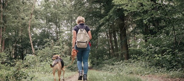
This tour from the LOWA series in search of metres in altitude in the Benelux takes you up the Kemmelberg in West Flanders. At 156 metres, it is also the highest mountain in this province.
This hike has quite a few metres in altitude by Belgian standards. 220 metres up and 220 metres down, to be precise. You start on the edge of the village of Kemmel and walk to Kasteel de Warande, a beautiful neo-Renaissance building dating from 1925.
Just as special are the menhirs you come across a few kilometres further on. A menhir is a large standing stone from the late Stone Age. In this case, it is a work of art entitled "The Ancestors - Les Ancètres" by Jean-Louis Muller. With structures made of willow branches, he makes the past a little more tangible.
You walk a little further through woodland into the open countryside, where you can enjoy the beautiful view. After around 12 kilometres, you reach the highest point of the route, the Kemmelberg.
Incidentally, the Kemmelberg is close to the Black Mountain (Mont Noir). Great if you make a weekend of it and look for accommodation or a campsite nearby. So this tour starts at a campsite near the Lettenberg, which is just 90 metres high. There are more hills in the neighbourhood, as the Kemmelberg is part of the so-called central ridge in Heuvelland.
-
 €200.00Technical light hiking boot with mid-cut shaft.
 -
 From €160.00 Regular Price €200.00coloursizeTechnical light hiking boot with mid-cut shaft.
 -
 From €160.00 Regular Price €200.00Sporty trekking boot with GORE-TEX membrane.
 -
 From €160.00 Regular Price €200.00Sporty trekking boot with GORE-TEX membrane.
 -
 From €185.00 Regular Price €230.00coloursizeThe classic multifunctional hiking boot in an new edition.
 -
 From €185.00 Regular Price €230.00The classic multifunctional hiking boot in an new edition.
